We started at 8:00am from China town,NY. The climate was cloudy. We booked a package tour to visit 1000 islands and Niagara falls. It will be 10hrs journey by road. We had a breakfast in Mcdonald. Had begal, burger and coke. Neeta bought sandwich and samosa. Girish prepared parotas. So we had nice breakfast there.
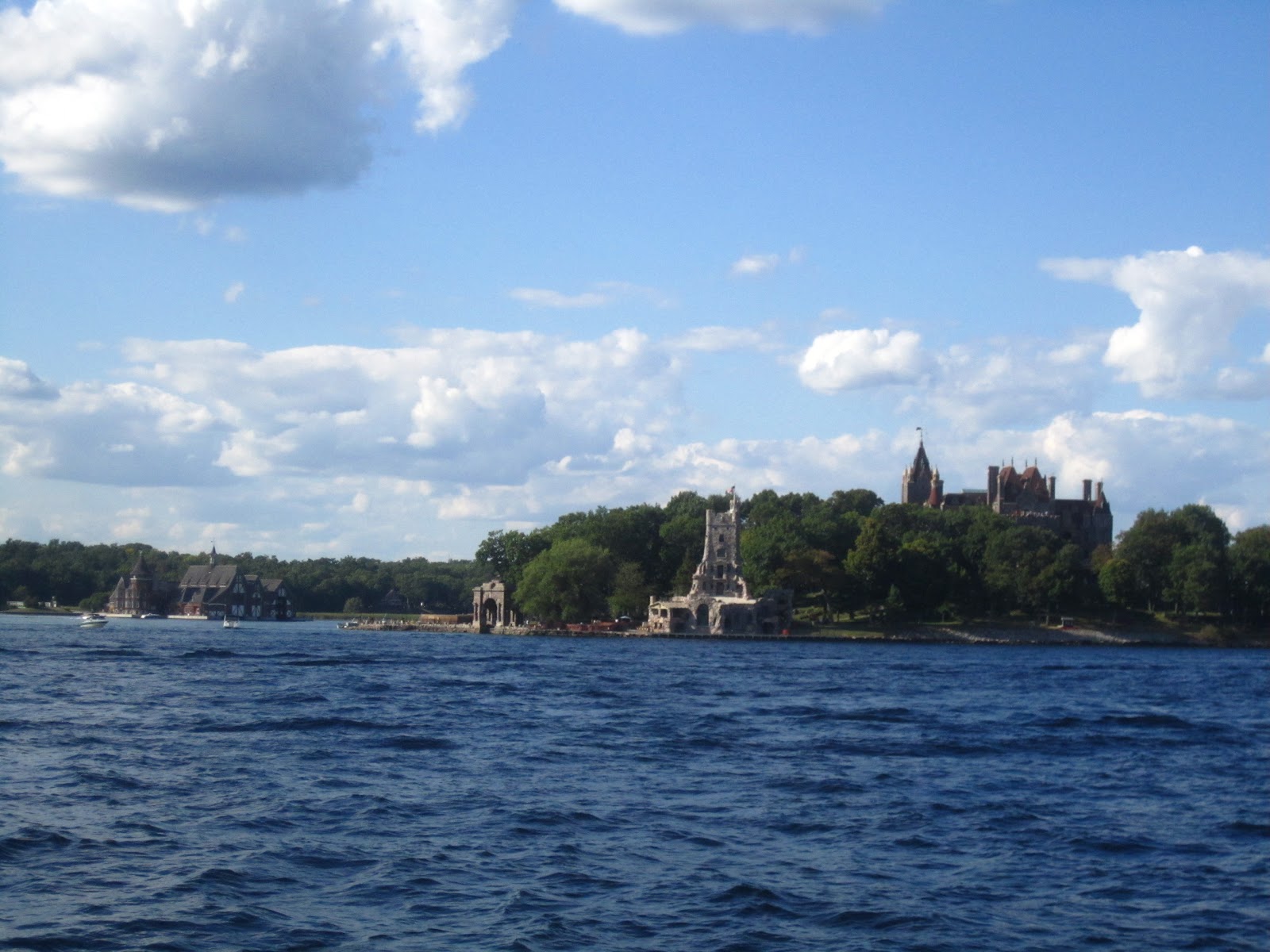
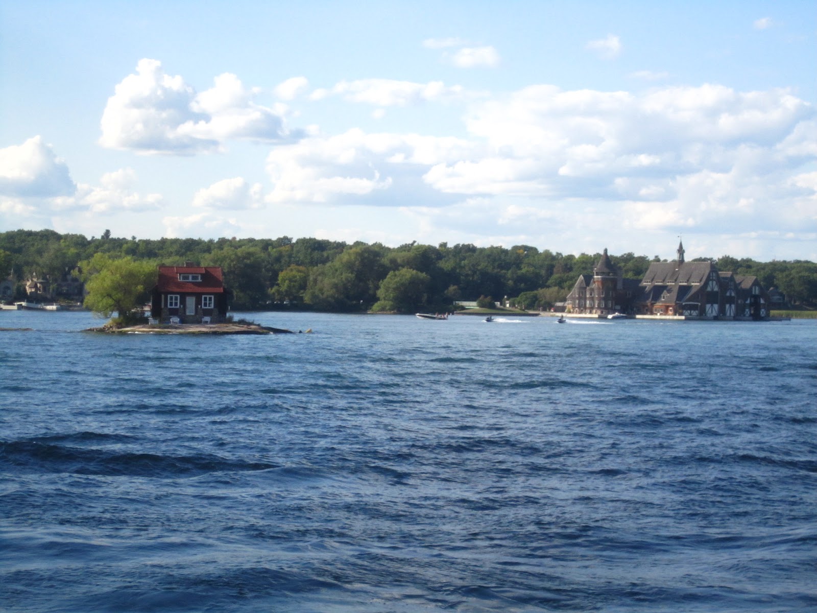
When we reached 1000 islands it was 4:00pm. We went by boat to look around the islands. There are small small islands which has house or trees in it. We saw one small international bridge between NY and Canada.
About 1000 islands
The 1000 Islands Region is an international tourism destination,
encompassing communities on both sides of the US and Canada border along
the St. Lawrence River and the eastern shores of Lake Ontario. The
region takes its name from the more than 1000 islands that dot the lake
and river along this international waterway. The region extends from
Kingson to Cornwall on the Canadian side, and from Oswego to Massena on
the US side, reaching inland to the foothills of the Adirondack
mountains to embrace the communities that are west and north of the
Adirondack Park, and the four NY Counties of Oswego, Jefferson, Lewis
and St. Lawrence.
The 1,864 islands range in size from over 40 square miles to smaller islands occupied by a single residence, or uninhabited outcroppings of rocks that are only home to migratory waterfowl. To count as one of the Thousand Islands these minimum criteria had to be met: 1) Above water level year round; 2) Have an area greater than 1 square foot and 3) Support at least one living tree.
We left 1000 islands and stayed in Holiday inn hotel. The next day our scheduled departure was at 7:00am. We couldn't found hotels for dinner, So we had parotas which we bought and slept nicely.
Sunday, September 2, 2012
Sunday, July 8, 2012
Monsoon trip to Goa
We have decided to visit Goa in Monsoon. So Naveen booked the train ticket for us well in advance. While going we went by Airavata club class.We got the bus at 8:30pm from Majestic and reached Panaji at 9:30am. When we reached it was drizzling, we got one omni to drop to resort. The cab guys charging more there. We got it for 300Rs. We didn't bargain since it was very cloudy morning. We have booked the resort near to Condolim called Ruffels resort. Naveen had full plan about beaches so we hired three activa and started our ride. First we went to Chopara fort, I have mentioned the series of places we visited on first day.
Chopara fort: Before this present fort build by Portuguese, there was a one fort way long before, even before the arrival of Portuguese in Goa.
In 1683, In order to put the end on Portugal’s rule in Goa, Prince Akbar joined the forces of Marathas, who were bitter enemies of his Father Aurangzeb at that time, revolting against his Father; he sought refuge with them and made this place as their base camp. However Portugal had a scary experience with Marathas, after a horrific recovery from Marathas, Portuguese strengthen harder their Northern Defenses, learning from the experience of Maratha they were required to give the shelter for the people of region, this was not before 1717, that this present fort was built.
An awesome site with all sides having steep slopes. The fort stands above the whole upland area having irregular outer plan, outline of the higher slopes, uses the natural contours to add defensive height to the fullest advantage instead of dry ditches being dug.
At the top of the steep approach track on the main gate, which is small and unpretentious for so large fort, is deep and narrow. Depending on their position of the defense requirement, the bastions with their enormous embrasures for cannon are irregularly spaced, each having the cylindrical turret that gives a special character.
Vagator beach: Vagator beach is one of the most scenic beaches in Goa that is situated immediately north of the Anjuna beach overlooked by steep hills.
The crescent shaped beach has become a favorite spot among tourists for midnight parties. The beach is also well known as the 500 Old Portuguese fort of Chapora is situated nearby.
Actually there are two beaches in Vagator known as Big Vagator and Small Vagator. Big Vagator lined with dense palm plantations and white sand is the main beach that is undeniably beautiful.
Anjuna beach: Besides the calm waters of the Arabian Sea lapping softly on the Indian shore, Anjuna comes alive with its ever-famous full-moon parties and the Wednesday flea market to take one onto a trip.
Baga beach: Baga beach is an option for those who want to be away from the hustle and bustle found on the other beaches.
Baga Beach in Goa looks as if it has come straight out of a painting… Majestic white waves rushing to wipe out the feet imprints left by you on the white sand while the wind continues to flirt with the palm trees.
Goa's Baga beach is a small but perfect beach located between its two more famous cousins, Anjuna on one side and Calangute on the other. It is a good place to enjoy some quite moments and dwell in peaceful contemplation with oneself.
Calangute beach: Calangute beach in Goa is also known as the Queen of Beaches. The period from November to February is the most pleasant to visit here. It's 15km from the capital city Panjim. The beach itself isn't anything special, with steeply shelving sand, however it's capacity is large enough to accommodate the huge number of high-season visitors.
The Calangute beach is usually crowded and the small resorts thrive in business during the holiday season. It is one of the most popular beach in Goa with a host of facilities to cater to visitors, including Golden sand along the beach and water sports.
Candolim beach: Candolim beach in Goa is well known as one can find some of the best seafood in Goa. The beach has quite a number of shacks and beach restaurants that serve tasty dishes and drinks. The long and straight Candolim beach is dotted with dunes that offer little shelter. Also offering comfortable accommodation at the Candolim beach in Goa are the many hotels, guest houses and beach resorts.
So we had covered maximum places in one day. We had dinner in hotel called Eric's Karaoke where many were singing a song for Karaoke music. One foreigner was very enthu and he sung Papa kehte hai song with his accent which was very nice...
The next day we decided to visit St. xavier church which is in old Goa. So we started at 10.00 and reached by 11:00.
Basilica Of BomJesus, Old Goa
The Basilica of Bom Jesus is the most august and famous of all the churches in Old Goa. It contains the relics of St. Francis Xavier, Patron saint of Goa, Apostle of the Indies. He was known as Goencho Saib by most of the people of Goa. The construction of the church began on the 24th November 1594 AD from the funds bequeathed for this purpose by Dom Jeronimos Mascarenhas. It was blessed by the Archbishop Dom Fr Aleixo de Menezes on the15th May1605 AD. It became the first church in India to be elevated to the status of a minor basilica in 1946.
We saw the museum which is other side of the church, took some pics and headed towards Dona paula beach.
Dona Paula beach: Dona Paula beach is located just about 7-km from Panaji. This place is called the Lovers Paradise in Goa, named after Dona Paula de Menezes. A myth has been attached to this place and according one legend the Viceroy's daughter after facing objections from her family about her love affair with a poor fisherman jumped of the cliff.
The enticing story is about a girl named Dona Paula de Menzes, after whom the Goa beach has been named. She was the daughter of a viceroy in colonial India, who threw herself off the cliff, when refused permission to marry a local fisherman, Gaspar Dias.
The place where two of Goa's famous rivers meet the Arabian Sea is the bay of Dona Paula with a very good view of the Marmagao Harbour. 7-km from Panjim, situated on the south side of the, hammer-shaped headland that divides the Zuari and Mandovi, is a Fishing Village. This is a spot to sunbathe and relax.
Miramar beach: Miramar beach is situated 3 kms from Panaji in North Goa. A lovely Golden beach of soft sand girdled with palm trees facing the blue Arabian Sea, is the nearest to Panaji. Miramar is an urban beach where the Mandovi River meets the Arabian Sea. It is not a safe beach to swim as there is a strong undercurrent.
It was almost 3:00pm when we finished visiting above places and it was raining also. So we decided to have lunch. We went to Delhi darbar and had nice lunch. The food was really awesome. We came back to our place Candolim and from there went towards Auguda fort.
Auguda Fort: The Fort Aguada is one of the largest and impressive forts preserved as one of the best known landmarks in Goan history. Its prominence has grown from the fact that its headland on which it is built offers a wonderful site for military architects due to its shielding of the vital sea access from the heart of the Portuguese territory thereby making it an ideal site for seaward as well as landward defense.
The elimination of the Maratha threat and the acquisition of the New Conquest added more glory to its importance right upto the end of the 18th century when Goa's future borders were established. The most vital part of it was its impregnability to survive attacks by enemies through land or sea or simultaneously from both sides which often happened.
The largest of all springs, the Mother of Water or Mae de Agua is also found here. This part of the fort is closed for visitors as it is utilized as a prison. At the new gates to the prison area, there is a statue of a man and a woman, the man holding the body of a child in his arms while the woman has her arms raised to show the breaking of chain bondage in front of the national emblem of India, the Ashoka Pillar which has an inscription which is dedicated to the memory of people, dead and alive, known and unknown and who have laid down their life for the cause of freedom from foreign powers.
Sinquerim beach: The Sinquerim beach is a beautiful beach that has a spectacular stretch of sand. It is located at the south of the famous beaches like Baga, Calangute and Candolim. It is an ideal place for swimming and one should not miss visiting this beach when on their travel to Goa for beach holidays.
The beach at Sinquerim lies adjacent to the Aguada beach. Near the beach one can see the famous historical Fort Aguada that was built by the Portuguese to defend them from any attack from the sea route.
So we almost finished visiting north Goa. While coming back from the beach we went to the cafe called Charcoal and had beer and onion pakoda with finger chips.
Next day morning we left to Mudgaon and our train was at 3:30. We had lunch at hotel Raviraj. Our train was on time but it stopped in Launda station for more than 1:30hrs.
It was really a wonderful and memorable journey and I am not sure whether we can make the plan to Goa in monsoon again. Its totally different experience. One more thing is most of the restaurants and cafe are closed in monsoon season and we have to search for food.
Chopara fort: Before this present fort build by Portuguese, there was a one fort way long before, even before the arrival of Portuguese in Goa.
In 1683, In order to put the end on Portugal’s rule in Goa, Prince Akbar joined the forces of Marathas, who were bitter enemies of his Father Aurangzeb at that time, revolting against his Father; he sought refuge with them and made this place as their base camp. However Portugal had a scary experience with Marathas, after a horrific recovery from Marathas, Portuguese strengthen harder their Northern Defenses, learning from the experience of Maratha they were required to give the shelter for the people of region, this was not before 1717, that this present fort was built.
An awesome site with all sides having steep slopes. The fort stands above the whole upland area having irregular outer plan, outline of the higher slopes, uses the natural contours to add defensive height to the fullest advantage instead of dry ditches being dug.
At the top of the steep approach track on the main gate, which is small and unpretentious for so large fort, is deep and narrow. Depending on their position of the defense requirement, the bastions with their enormous embrasures for cannon are irregularly spaced, each having the cylindrical turret that gives a special character.
Vagator beach: Vagator beach is one of the most scenic beaches in Goa that is situated immediately north of the Anjuna beach overlooked by steep hills.
The crescent shaped beach has become a favorite spot among tourists for midnight parties. The beach is also well known as the 500 Old Portuguese fort of Chapora is situated nearby.
Actually there are two beaches in Vagator known as Big Vagator and Small Vagator. Big Vagator lined with dense palm plantations and white sand is the main beach that is undeniably beautiful.
Anjuna beach: Besides the calm waters of the Arabian Sea lapping softly on the Indian shore, Anjuna comes alive with its ever-famous full-moon parties and the Wednesday flea market to take one onto a trip.
Baga beach: Baga beach is an option for those who want to be away from the hustle and bustle found on the other beaches.
Baga Beach in Goa looks as if it has come straight out of a painting… Majestic white waves rushing to wipe out the feet imprints left by you on the white sand while the wind continues to flirt with the palm trees.
Goa's Baga beach is a small but perfect beach located between its two more famous cousins, Anjuna on one side and Calangute on the other. It is a good place to enjoy some quite moments and dwell in peaceful contemplation with oneself.
Calangute beach: Calangute beach in Goa is also known as the Queen of Beaches. The period from November to February is the most pleasant to visit here. It's 15km from the capital city Panjim. The beach itself isn't anything special, with steeply shelving sand, however it's capacity is large enough to accommodate the huge number of high-season visitors.
The Calangute beach is usually crowded and the small resorts thrive in business during the holiday season. It is one of the most popular beach in Goa with a host of facilities to cater to visitors, including Golden sand along the beach and water sports.
Candolim beach: Candolim beach in Goa is well known as one can find some of the best seafood in Goa. The beach has quite a number of shacks and beach restaurants that serve tasty dishes and drinks. The long and straight Candolim beach is dotted with dunes that offer little shelter. Also offering comfortable accommodation at the Candolim beach in Goa are the many hotels, guest houses and beach resorts.
So we had covered maximum places in one day. We had dinner in hotel called Eric's Karaoke where many were singing a song for Karaoke music. One foreigner was very enthu and he sung Papa kehte hai song with his accent which was very nice...
The next day we decided to visit St. xavier church which is in old Goa. So we started at 10.00 and reached by 11:00.
Basilica Of BomJesus, Old Goa
The Basilica of Bom Jesus is the most august and famous of all the churches in Old Goa. It contains the relics of St. Francis Xavier, Patron saint of Goa, Apostle of the Indies. He was known as Goencho Saib by most of the people of Goa. The construction of the church began on the 24th November 1594 AD from the funds bequeathed for this purpose by Dom Jeronimos Mascarenhas. It was blessed by the Archbishop Dom Fr Aleixo de Menezes on the15th May1605 AD. It became the first church in India to be elevated to the status of a minor basilica in 1946.
We saw the museum which is other side of the church, took some pics and headed towards Dona paula beach.
Dona Paula beach: Dona Paula beach is located just about 7-km from Panaji. This place is called the Lovers Paradise in Goa, named after Dona Paula de Menezes. A myth has been attached to this place and according one legend the Viceroy's daughter after facing objections from her family about her love affair with a poor fisherman jumped of the cliff.
The enticing story is about a girl named Dona Paula de Menzes, after whom the Goa beach has been named. She was the daughter of a viceroy in colonial India, who threw herself off the cliff, when refused permission to marry a local fisherman, Gaspar Dias.
The place where two of Goa's famous rivers meet the Arabian Sea is the bay of Dona Paula with a very good view of the Marmagao Harbour. 7-km from Panjim, situated on the south side of the, hammer-shaped headland that divides the Zuari and Mandovi, is a Fishing Village. This is a spot to sunbathe and relax.
Miramar beach: Miramar beach is situated 3 kms from Panaji in North Goa. A lovely Golden beach of soft sand girdled with palm trees facing the blue Arabian Sea, is the nearest to Panaji. Miramar is an urban beach where the Mandovi River meets the Arabian Sea. It is not a safe beach to swim as there is a strong undercurrent.
It was almost 3:00pm when we finished visiting above places and it was raining also. So we decided to have lunch. We went to Delhi darbar and had nice lunch. The food was really awesome. We came back to our place Candolim and from there went towards Auguda fort.
Auguda Fort: The Fort Aguada is one of the largest and impressive forts preserved as one of the best known landmarks in Goan history. Its prominence has grown from the fact that its headland on which it is built offers a wonderful site for military architects due to its shielding of the vital sea access from the heart of the Portuguese territory thereby making it an ideal site for seaward as well as landward defense.
The elimination of the Maratha threat and the acquisition of the New Conquest added more glory to its importance right upto the end of the 18th century when Goa's future borders were established. The most vital part of it was its impregnability to survive attacks by enemies through land or sea or simultaneously from both sides which often happened.
The largest of all springs, the Mother of Water or Mae de Agua is also found here. This part of the fort is closed for visitors as it is utilized as a prison. At the new gates to the prison area, there is a statue of a man and a woman, the man holding the body of a child in his arms while the woman has her arms raised to show the breaking of chain bondage in front of the national emblem of India, the Ashoka Pillar which has an inscription which is dedicated to the memory of people, dead and alive, known and unknown and who have laid down their life for the cause of freedom from foreign powers.
Sinquerim beach: The Sinquerim beach is a beautiful beach that has a spectacular stretch of sand. It is located at the south of the famous beaches like Baga, Calangute and Candolim. It is an ideal place for swimming and one should not miss visiting this beach when on their travel to Goa for beach holidays.
The beach at Sinquerim lies adjacent to the Aguada beach. Near the beach one can see the famous historical Fort Aguada that was built by the Portuguese to defend them from any attack from the sea route.
So we almost finished visiting north Goa. While coming back from the beach we went to the cafe called Charcoal and had beer and onion pakoda with finger chips.
Next day morning we left to Mudgaon and our train was at 3:30. We had lunch at hotel Raviraj. Our train was on time but it stopped in Launda station for more than 1:30hrs.
It was really a wonderful and memorable journey and I am not sure whether we can make the plan to Goa in monsoon again. Its totally different experience. One more thing is most of the restaurants and cafe are closed in monsoon season and we have to search for food.
Monday, December 27, 2010
Matheran
Matheran (Marathi: Marathi: माथेरान is a city and a Hill Station municipal council in Raigad district in the Indian state of Maharashtra. It is a hill station in Karjat Tahsil and is also the smallest hill station in India. It is located on the Western Ghats range at an elevation of around 800 m (2,625 feet) above sea level. It is located around 90 km from Mumbai, and 120 km from Pune. Matheran's proximity to the three Metros makes it a popular weekend getaway for urban residents. The name Matheran means either "forest on top" or "mother forest".
It was late when we reached Neral. We started our journey from Pune and we got the train which goes to Karjat. We had to get down in Neral. The journey was horrible because the train was too crowded. We did miss the site scene while we travel to Neral. We got to see many tunnels and bridges which reminds me our picnic to Yadakumeri. once we reached Neral thought of staying in Neral since we were not sure whether we get the vehicle or not. But Navs was not willing to go back to Mumbai by skipping Matheran. So I had to stay back with him. We were waiting for long for the cabs. Actually there are lot of omnis which take you to the peak but they need 5 passengers. Later three people came and so we went to the top. The vehicles will go to some point later we have to walk or ride on horse. We decided to walk. It was so dark that time,I was not sure whether we will get room or not. But still we went up. Once we make to the peak we started searching for room. So we got it in one small home stay. We stayed there. Morning we started to explore the places around. Better come to the peak by train. Since we couldn't get teh tickets we had to come by omni. The train starts from Neral station itself.
Matheran is an eco-sensitive region, declared by the Ministry of Environment and Forest, Government of India. It is one of the few places in the world where vehicles are not allowed, which makes the place different from others. Matheran takes you over a hundred years back in time when there were no vehicles.
Because of vehicles being banned in Matheran, the place is quite peaceful despite the thousands of visitors coming to visit throughout the year.
There are lots of lookout points that provide spectacular views of the surrounding hills and valleys. Matheran has a reasonably dense forest cover.
There are around 38 designated look-out points in Matheran, including the Panorma Point that provides a 360 degree view of the surrounding area and also the Neral town. From this point, the view of sunset and sunrise is breathtaking. The Louisa Point offers crystal clear view of the Prabal Fort. The other points are the One Tree Hill Point, Hart Point, Monkey Point, Porcupine Point, Rambgh Point, and more.
History
Matheran was discovered by Hugh Poyntz Malet, the then district collector of Thane district in May 1850. Lord Elphinstone, the then Governor of Bombay laid the foundations of the development as a future hill station. The British developed Matheran as a popular resort to beat the summer heat in the region.
How to reach
One can go via Mumbai/Pune. The toy train will get from Neral station. Should book well in advance.
Total distance
Appro. 6-8 kms from Neral railway station.
It was late when we reached Neral. We started our journey from Pune and we got the train which goes to Karjat. We had to get down in Neral. The journey was horrible because the train was too crowded. We did miss the site scene while we travel to Neral. We got to see many tunnels and bridges which reminds me our picnic to Yadakumeri. once we reached Neral thought of staying in Neral since we were not sure whether we get the vehicle or not. But Navs was not willing to go back to Mumbai by skipping Matheran. So I had to stay back with him. We were waiting for long for the cabs. Actually there are lot of omnis which take you to the peak but they need 5 passengers. Later three people came and so we went to the top. The vehicles will go to some point later we have to walk or ride on horse. We decided to walk. It was so dark that time,I was not sure whether we will get room or not. But still we went up. Once we make to the peak we started searching for room. So we got it in one small home stay. We stayed there. Morning we started to explore the places around. Better come to the peak by train. Since we couldn't get teh tickets we had to come by omni. The train starts from Neral station itself.
Matheran is an eco-sensitive region, declared by the Ministry of Environment and Forest, Government of India. It is one of the few places in the world where vehicles are not allowed, which makes the place different from others. Matheran takes you over a hundred years back in time when there were no vehicles.
Because of vehicles being banned in Matheran, the place is quite peaceful despite the thousands of visitors coming to visit throughout the year.
There are lots of lookout points that provide spectacular views of the surrounding hills and valleys. Matheran has a reasonably dense forest cover.
There are around 38 designated look-out points in Matheran, including the Panorma Point that provides a 360 degree view of the surrounding area and also the Neral town. From this point, the view of sunset and sunrise is breathtaking. The Louisa Point offers crystal clear view of the Prabal Fort. The other points are the One Tree Hill Point, Hart Point, Monkey Point, Porcupine Point, Rambgh Point, and more.
History
Matheran was discovered by Hugh Poyntz Malet, the then district collector of Thane district in May 1850. Lord Elphinstone, the then Governor of Bombay laid the foundations of the development as a future hill station. The British developed Matheran as a popular resort to beat the summer heat in the region.
How to reach
One can go via Mumbai/Pune. The toy train will get from Neral station. Should book well in advance.
Total distance
Appro. 6-8 kms from Neral railway station.
Thursday, December 23, 2010
Daulatabad fort, Aurangabad
We had visited Daulatabad fort on Dec 23rd 2010.Once we finished visiting Ellora caves on the way back we visited teh fort. It was a very huge fort and still strong enough. It was built very nicely and unfortunately we couldn't click more pics since our camera battery got exhausted. Still we keep teh memories.
History
Daulatabad (meaning “City of Prosperity”), is a 14th century fort city in Maharashtra, India, about 16 kilometers northwest of Aurangabad. The place, was once as known as Deogiri, (circa the sixth century AD, when it was an important uplands city along caravan routes and is now but a village, based around the former city of the same name.
Starting 1327, it famously remained the capital of Tughlaq dynasty, under Muhammad bin Tughluq (r. 1325-1351), who also changed its name, and forcibily moved the entire population of Delhi here, for two years, before it was abandoned due to lack of water.
Once known as 'Devgiri', this magnificent 12th century fortress stands on a hill just 13 km. from Aurangabad. It was given the name Daulatabad, the 'city of fortune', by Muhammad Tughlaq, Sultan of Delhi. Initially a Yadav stronghold, it passed through the hands of several dynasties in the Deccan. One of the world's best preserved fort of medieval times, surviving virtually unaltered, Daulatabad yet displays the character that made it invincible.
Arguably amongst the best constructed forts all over the world, this fort never in its lifetime witnessed a battle. Only once was the power transferred on this fort, and that too was by treachery!
It has 7 lines of defense all the way up to the Baradari (palatial building on the top) and each line is constructed in such a way, that even if that line is captured, it is impossible to use it to attack the fort by directing the fire inwards.
A series of secret, quizzical, subterranean passages lie coiled like a python amidst the fort. Here flaring torches were thrust upon an unwary enemy. Or hot oil poured down his path, as he deliberated in the labyrinth. Also the heat from a brazier was blown into the passage by a process of suction suffocating the entire garrison within. The Fort itself lies in the body of an isolated hill; the steep hill - sides at the base falling so sharply to the moat that no hostile troops could scale the height.
The moat, 40 ft. deep and carved into solid rock with mechanical drawbridges teemed with crocodiles. A 5-kilometer sturdy wall, artificial scarping and a complicated series of defenses made Daulatabad impregnable.
The 30-meter high Chand Minar (Tower) built much later with 3 circular galleries had a defensive and religious role in the fortress.
The area of the city includes the hill-fortress of Devagiri (sometimes Latinised to Deogiri). It stands on a conical hill, about 200 meters high. Much of the lower slopes of the hill has been cut away by Yadava dynasty rulers to leave 50 meter vertical sides to improve defenses. The fort is a place of extraordinary strength. The only means of access to the summit is by a narrow bridge, with passage for not more than two people abreast, and a long gallery, excavated in the rock, which has for the most part a very gradual upward slope.
About midway along this gallery, the access gallery has steep stairs, the top of which is covered by a grating destined in time of war to form the hearth of a huge fire kept burning by the garrison above. At the summit, and at intervals on the slope, are specimens of massive old cannon facing out over the surrounding countryside. Also at the mid way, there is a cave entrance meant to confuse the Enemies.
The Fort which according to Indian ancient texts falls under the classification of Misra durg or mixed fort as it combines the qualities of Giridurg (mountain fort), Dev durg (God's fort) and Bhumi durg (land fort). The fortification walls were built at different periods by different dynasites like the Yadavas, Khilji, Tughlaq, Bahamani, Nizam Shahi and Malik Amber bears a marked resemblance to medieval European forts in the disposition of projecting towers, covered passages and bastions. The walls consist of arrangements of the underground secret passage with safety arrangements, in the style of buildings which give the bastions, despite their grim appearances, a touch of beauty by insertions of carved stones and dainty architectural details at various places.
The fort has been considered as the most powerful, puissant fort that offered robust resistance to the enemies. An invincible fort, one of the best preserved in comparison to other forts in the vicinity of the same period. Its sound and sturdy quality exists due to the powerful wall about three miles in perimeter and defended by a moat and gacis that runs round the hill at its foot and between this outer curtain and the citadel, also known as Dharagir and Duwagir. These details have been extracted from Professor Dulari Qureshi's book Fort of Daulatabad.
How to reach
Same as Ellora caves
History
Daulatabad (meaning “City of Prosperity”), is a 14th century fort city in Maharashtra, India, about 16 kilometers northwest of Aurangabad. The place, was once as known as Deogiri, (circa the sixth century AD, when it was an important uplands city along caravan routes and is now but a village, based around the former city of the same name.
Starting 1327, it famously remained the capital of Tughlaq dynasty, under Muhammad bin Tughluq (r. 1325-1351), who also changed its name, and forcibily moved the entire population of Delhi here, for two years, before it was abandoned due to lack of water.
Once known as 'Devgiri', this magnificent 12th century fortress stands on a hill just 13 km. from Aurangabad. It was given the name Daulatabad, the 'city of fortune', by Muhammad Tughlaq, Sultan of Delhi. Initially a Yadav stronghold, it passed through the hands of several dynasties in the Deccan. One of the world's best preserved fort of medieval times, surviving virtually unaltered, Daulatabad yet displays the character that made it invincible.
Arguably amongst the best constructed forts all over the world, this fort never in its lifetime witnessed a battle. Only once was the power transferred on this fort, and that too was by treachery!
It has 7 lines of defense all the way up to the Baradari (palatial building on the top) and each line is constructed in such a way, that even if that line is captured, it is impossible to use it to attack the fort by directing the fire inwards.
A series of secret, quizzical, subterranean passages lie coiled like a python amidst the fort. Here flaring torches were thrust upon an unwary enemy. Or hot oil poured down his path, as he deliberated in the labyrinth. Also the heat from a brazier was blown into the passage by a process of suction suffocating the entire garrison within. The Fort itself lies in the body of an isolated hill; the steep hill - sides at the base falling so sharply to the moat that no hostile troops could scale the height.
The moat, 40 ft. deep and carved into solid rock with mechanical drawbridges teemed with crocodiles. A 5-kilometer sturdy wall, artificial scarping and a complicated series of defenses made Daulatabad impregnable.
The 30-meter high Chand Minar (Tower) built much later with 3 circular galleries had a defensive and religious role in the fortress.
The area of the city includes the hill-fortress of Devagiri (sometimes Latinised to Deogiri). It stands on a conical hill, about 200 meters high. Much of the lower slopes of the hill has been cut away by Yadava dynasty rulers to leave 50 meter vertical sides to improve defenses. The fort is a place of extraordinary strength. The only means of access to the summit is by a narrow bridge, with passage for not more than two people abreast, and a long gallery, excavated in the rock, which has for the most part a very gradual upward slope.
About midway along this gallery, the access gallery has steep stairs, the top of which is covered by a grating destined in time of war to form the hearth of a huge fire kept burning by the garrison above. At the summit, and at intervals on the slope, are specimens of massive old cannon facing out over the surrounding countryside. Also at the mid way, there is a cave entrance meant to confuse the Enemies.
The Fort which according to Indian ancient texts falls under the classification of Misra durg or mixed fort as it combines the qualities of Giridurg (mountain fort), Dev durg (God's fort) and Bhumi durg (land fort). The fortification walls were built at different periods by different dynasites like the Yadavas, Khilji, Tughlaq, Bahamani, Nizam Shahi and Malik Amber bears a marked resemblance to medieval European forts in the disposition of projecting towers, covered passages and bastions. The walls consist of arrangements of the underground secret passage with safety arrangements, in the style of buildings which give the bastions, despite their grim appearances, a touch of beauty by insertions of carved stones and dainty architectural details at various places.
The fort has been considered as the most powerful, puissant fort that offered robust resistance to the enemies. An invincible fort, one of the best preserved in comparison to other forts in the vicinity of the same period. Its sound and sturdy quality exists due to the powerful wall about three miles in perimeter and defended by a moat and gacis that runs round the hill at its foot and between this outer curtain and the citadel, also known as Dharagir and Duwagir. These details have been extracted from Professor Dulari Qureshi's book Fort of Daulatabad.
How to reach
Same as Ellora caves
Ellora caves,Aurangabad


We left Mumbai on 22nd Dec night around 9:00pm Davagiri exress train to Aurangabad. We reached Aurangabad around 4:30am in the morning. From there we got a taxi to reach our hotel called Panchavati. We took rest till 7:30am and once we finished our breakfast we asked the travelling agency to book a car for us. So we hired Indica on that day and headed towrds Ellora caves. It will take 3-4hrs to go around the caves. Suggested to hire taxi and hire guide as well.
Ellora is an archaeological site, 30 km (19 mi) from the city of Aurangabad in the Indian state of Maharashtra built by the Rashtrakuta rulers. Well-known for its monumental caves, Ellora is a World Heritage Site. Ellora represents the epitome of Indian rock-cut architecture. The 34 "caves" – actually structures excavated out of the vertical face of the Charanandri hills – being Buddhist, Hindu and Jain rock cut temples and monasteries, were built between the 5th century and 10th century. The 12 Buddhist (caves 1–12), 17 Hindu (caves 13–29) and 5 Jain (caves 30–34) caves, built in proximity, demonstrate the religious harmony prevalent during this period of Indian history.
Buddhist and Hindus caves
It was initially thought that the Buddhist caves were one of the earliest structures, created between the fifth and eighth centuries, with caves 1-5 in the first phase (400-600) and 6-12 in the later phase (mid 7th-mid 8th), but now it is clear to the modern scholars that some of the Hindu caves (27,29,21,28,19,26,20,17 and 14) precede these caves. The earliest Buddhist cave is Cave 6, followed by 5,2,3,5 (right wing), 4,7,8,10 and 9. Caves 11 and 12 were the last. All the Buddhist caves were constructed between 630-700.
These structures consist mostly of viharas or monasteries: large, multi-storeyed buildings carved into the mountain face, including living quarters, sleeping quarters, kitchens, and other rooms. Some of these monastery caves have shrines including carvings of Buddha, bodhisattvas and saints. In many of these caves, sculptors have endeavoured to give the stone the look of wood.
Most famous of the Buddhist caves is cave 10, a chaitya hall (chandrashala) or 'Vishvakarma cave', popularly known as the "Carpenter's Cave". Beyond its multi-storeyed entry is a cathedral-like stupa hall also known as chaitya, whose ceiling has been carved to give the impression of wooden beams. At the heart of this cave is a 15-foot statue of Buddha seated in a preaching pose. Amongst other Buddhist caves, all of the first nine (caves 1–9) are monasteries. The last two caves, Do Tal (cave 11) and Tin Tal (cave 12) have three stories.
Cave 1 is a vihara with eight cells, four in the back wall and four in the right wall. It had a portico in the front with a cell.Possibly served as a granary for other viharas.
The Vishvakarma (Cave 10) is the only chaitya griha amongst the Buddhist group of caves. It is locally known as Vishvakarma or Sutar ka jhopda (carpenter's hut). It follows the pattern of construction of Caves 19 and 26 of Ajanta. On stylistic grounds, the date of construction of this cave is assigned to c.700. The chaitya once had a high screen wall, which is ruined at present. At the front is a rock-cut court, which is entered through a flight of steps. On either side are pillared proticos with chambers in their back walls. These were probably intended to have subsidiary shrines but not completed. The pillared verandah of the chaitya has a small shrine at either end and a single cell in the far end of the back wall. The corridor columns have massive squarish shafts and ghata-pallava (vase and foliage) capitals. The main hall is apsidal on plan and is divided in to a central nave and side aisles by 28 octagonal columns with plain bracket capitals. In the apsidal end of the chaitya hall is a stupa on the face of which a colossal 3.30 m high seated Buddha in vyakhyana mudra (teaching posture) is carved. A large Bodhi tree (Ficus religiosa) is carved at the back. The hall has a vaulted roof in which ribs have been carved in the rock imitating the wooden ones.
The Hindu caves were constructed between the middle of sixth century to the end of the eighth century. The early caves (caves 17–29) were constructed during the Kalachuri period. The work first commenced in Caves 28, 27 and 19. These were followed by two most impressive caves constructed in the early phase - Caves 29 and 21. Along with these two, work was underway at Caves 20 and 26, and slightly later at Caves 17, 19 and 28. The caves 14, 15 and 16 were constructed during the Rashtrakuta period. The work began in Caves 14 and 15 and culminated in Cave 16. All these structures represent a different style of creative vision and execution skills. Some were of such complexity that they required several generations of planning and co-ordination to complete.
Cave 16, also known as the Kailasa or the Kailasanatha, is the unrivaled centerpiece of Ellora. This is designed to recall Mount Kailash, the abode of Lord Shiva – looks like a freestanding, multi-storeyed temple complex, but it was carved out of one single rock, and covers an area double the size of Parthenon in Athens. Initially the temple was covereed with white plaster thus even more increasing the similarity to snow covered Mount Kailash.
All the carvings are done in more than one level. A two-storeyed gateway resembling a South Indian gopuram opens to reveal a U-shaped courtyard. The courtyard is edged by columned galleries three storeys high. The galleries are punctuated by huge sculpted panels, and alcoves containing enormous sculptures of a variety of deities. Originally flying bridges of stone connected these galleries to central temple structures, but these have fallen.
Within the courtyard are three structures. As is traditional in Shiva temples, first is large image of the sacred bull Nandi in the front of the central temple. Central temple - Nandi Mandap - is housing the lingam. Nandi Mandap stands on 16 pillars and is 29.3 m high. The base of the Nandi Mandap has been carved to suggest that life-sized elephants are holding the structure aloft. A living rock bridge connects the Nandi Mandap to the Shiva temple behind it. The temple itself is tall pyramidal structure reminiscent of a South Indian temple. The shrine – complete with pillars, windows, inner and outer rooms, gathering halls, and an enormous lingam at its heart – carved from living stone, is carved with niches, pilasters, windows as well as images of deities, mithunas (erotic male and female figures) and other figures. Most of the deities at the left of the entrance are Shaivaite (followers of Shiva) while on the right hand side the deities are Vaishnavaites (followers of Vishnu). There are two Dhvajastambhas (pillars with the flagstaff) in the courtyard. The grand sculpture of Ravana attempting to lift Mount Kailasa, the abode of Lord Shiva, with his full might is a landmark in Indian art. The construction of this cave was a feat of human genius – it entailed removal of 200,000 tonnes of rock, and took 100 years to complete.
The temple is a splendid achievement of Dravidian art. This project was started by Krishna I (757–773) of the Rashtrakuta dynasty that ruled from Manyakheta in present day Karnataka state. His rule had also spread to southern India, hence this temple was excavated in the prevailing style. Its builders modelled it on the lines of the Virupaksha Temple in Pattadakal. Being a south Indian style temple, it does not have a shikhara common to north Indian temples. – The Guide to the Architecture of the Indian Subcontinent, 1996, Takeo Kamiya, Japan Architects Academy and archaeological Survey of India.
The Dashavatara (Cave 15) was begun as a Buddhist monastery. It has an open court with a free-standing monolithic mandapa at the middle and a two-storeyed excavated temple at the rear. The layout of the temple is closely related to caves 11 and 12. Large sculptural panels between the wall columns on the upper floor illustrate a wide range of themes, which include the ten avataras of Vishnu. An inscription of grant of Dantidurga is found on the back wall of the front mandapa. According to Coomaraswamy, the finest relief of this cave is the one depicting the death of Hiranyakashipu, where Vishnu in man-lion (Narasimha) form, emerges from a pillar to lay a fatal hand upon the shoulder of Hiranyakashipu.
Other notable Hindu caves are the Rameshvara (Cave 21), which has figurines of river goddesses Ganga and Yamuna at the entrance and the Dhumar Lena (Cave 29) whose design is similar to the cave temple on Elephanta Island near Mumbai. Two other caves, the Ravan ki Khai (Cave 14) and the Nilkantha (Cave 22) also have several sculptures. The rest of the Hindu caves, which include the Kumbharvada (Cave 25) and the Gopilena (Cave 27) have no significant sculptures.
Jain caves
The five Jain caves at Ellora belong to the ninth and tenth centuries. They all belong to the Digambara sect. Jain caves reveal specific dimensions of Jain philosophy and tradition. They reflect a strict sense of asceticism – they are not relatively large as compared to others, but they present exceptionally detailed art works. The most remarkable Jain shrines are the Chhota Kailash (cave 30), the Indra Sabha (cave 32) and the Jagannath Sabha (cave 33). Cave 31 is an unfinished four-pillared hall and a shrine. Cave 34 is a small cave, which can be approached through an opening on the left side of Cave 33.
he Indra Sabha (Cave 32) is a two storeyed cave with one more monolithic shrine in its court. It has a very fine carving of the lotus flower on the ceiling. It got the appellation, Indra Sabha probably it is significantly ornate and also because of the sculpture of Yaksha Matanga on an elephant, which was wrongly identified as that of Indra. On the upper level of the double-storied shrine excavated at the rear of the court, an imposing image of Ambika, the Yakshi (dedicated attendant deity) of Neminatha is found seated on her lion under a mango tree, laden with fruits.
How to reach
Hire private vehicle/MTDC bus from Aurangabad to visit the places.
Total distance
30km from Aurangabad.
Nearest places to visit
Daulatabad fort,Bibi-ka-Muqabara,Ghrishneshwara temple
Wednesday, December 22, 2010
Elephanta caves,Mumbai,Maharastra


This time we had planned for longer trip and Naveen had started exploring places in Mumbai,so he suggested to visit Elephanta caves in Mumbai. We have started from Bangalore in the morning flight around 5:50am and reached Mumbai at 7:30am. We stayed in my cousin's room in Andheri(E). Around 12:00 we caught the local train(fast train to Churchgate and by the time we reached churchgate it was 1:30pm. So we sat in boat and headed towards elephanta caves. Its almost 1:30hrs journey by boat to reach the place. They will charge 130Rs per trip.
The Elephanta Caves are a network of sculpted caves located on Elephanta Island, or Gharapuri (literally "the city of caves") in Mumbai Harbour, 10 kilometres (6.2 mi) to the east of the city of Mumbai in the Indian state of Maharashtra. The island, located on an arm of the Arabian Sea, consists of two groups of caves—the first is a large group of five Hindu caves, the second, a smaller group of two Buddhist caves. The Hindu caves contain rock cut stone sculptures, representing the Shaiva Hindu sect, dedicated to the god Shiva.
The rock cut architecture of the caves has been dated to between the 5th and 8th centuries, although the identity of the original builders is still a subject of debate. The caves are hewn from solid basalt rock. All the caves were also originally painted in the past, but now only traces remain.
The main cave (Cave 1, or the Great Cave) was a Hindu place of worship until Portuguese rule began in 1534, after which the caves suffered severe damage. This cave was renovated in the 1970s after years of neglect, and was designated a UNESCO World Heritage Site in 1987 to preserve the artwork. It is currently maintained by the Archaeological Survey of India (ASI)
The island is 1.5 miles (2.4 km) in length with two hills that rise to a height of about 500 feet (150 m). A deep ravine cuts through the heart of the island from north to south. On the west, the hill rises gently from the sea and stretches east across the ravine and rises gradually to the extreme east to a height of 568 feet (173 m). This hill is known as the Stupa hill. Forest growth with clusters of mango, tamarind, and karanj trees cover the hills with scattered palm trees. Rice fields are seen in the valley. The fore shore is made up of sand and mud with mangrove bushes on the fringe. Landing quays sit near three small hamlets known as Set Bunder in the north-west, Mora Bunder in the northeast, and Gharapuri or Raj Bunder in the south.
The two hills of the island, the western and the eastern, have five rock-cut caves in the western part and a brick stupa on the eastern hill on its top composed of two caves with few rock-cut cisterns. One of the caves on the eastern hill is unfinished. It is a protected island with a buffer zone according to a Notification issued in 1985, which also includes “a prohibited area” that stretches 1 kilometre (0.62 mi) from the shoreline.
History
Since no inscriptions on any of the caves on the island have been discovered, the ancient history of the island is conjectural, at best. Pandava, the hero of the Hindu epic Mahabharata, and Banasura, the demon devotee of Shiva, are both credited with building temples or cut caves to live. Local tradition holds that the caves are not man-made.
The Elephanta caves are "of unknown date and attribution". Art historians have dated the caves in the range of late 5th to late 8th century AD. Archaeological excavations have unearthed a few Kshatrapa coins dated to 4th century AD. The known history is traced only to the defeat of Mauryan rulers of Konkan by the Badami Chalukyan emperor Pulakesi II (609–642) in a naval battle, in 635 AD. Elephanta was then called Puri or Purika, and served as the capital of the Konkan Mauryas. Some historians attribute the caves to the Konkan Mauryas, dating them to the mid 6th century, though others refute this claim saying a relatively small kingdom like the Konkan Mauryas could not undertake "an almost superhuman excavation effort," which was needed to carve the rock temples from solid rock and could not have the skilled labor to produce such "high quality" sculpture.
Some other historians attribute the construction to the Kalacuris (late 5th to 6th century), who may have had a feudal relationship with the Konkan Mauryas. In an era where polytheism was prevalent, the Elephanta main cave dedicates the monotheism of the Pashupata Shaivism sect, a sect to which Kalacuris as well as Konkan Mauryas belonged.
The Chalukyas, who defeated the Kalacuris as well as the Konkan Mauryas, are also believed by some to be creators of the main cave, in the mid 7th century. The Rashtrakutas are the last claimants to the creation of the main cave, approximated to the early 7th to late 8th century. The Elephanta Shiva cave resembles in some aspects the 8th century Rashtrakuta rock-temple Kailash at Ellora. The Trimurti of Elephanta showing the three faces of Shiva is akin to the Trinity of Brahma, Vishnu and Mahesh (Shiva), which was the royal insignia of the Rashtrakutas. The Nataraja and Ardhanarishvara sculptures are also attributed to the Rashtrakutas.
Later, Elephanta was ruled by another Chalukyan dynasty, and then by Gujarat Sultanate, who surrendered it to the Portuguese in 1534. By then, Elephanta was called Gharapuri, which denotes a hill settlement. The name is still used in the local Marathi language. The Portuguese named the island "Elephanta Island" in honour of a huge rock-cut black stone statue of an elephant that was then installed on a mound, a short distance east of Gharapuri village. The elephant now sits in the Jijamata Udyaan zoo in Mumbai.
Though the main cave was restored in the 1970s, other caves, including three consisting of important sculptures, are still badly damaged. The caves were designated a UNESCO World Heritage Site in 1987 as per the cultural criteria of UNESCO: the caves "represent a masterpiece of human creative genius" and "bear a unique or at least exceptional testimony to a cultural tradition or to a civilization which is living or which has disappeared".
How to go
One can reach Elephanta caves via Churchgate/gate way of India. There will be lot of boats which will take you to the island.
Friday, November 26, 2010
Two days in Bay of Bengal


Brief note about Pondy
The Union Territory of puducherry comprises of four coastal regions viz- puducherry, Karaikal, Mahe and Yanam. puducherry and Karaikal are situated on the East Coasts in Tamil Nadu, Yanam in Andra Pradesh and Mahe on the West Coast in Kerala.
puducherry is the Capital of this Union Territory. It is on the east coast about 162 kms south of Chennai (Madras) located on the Coromandel Coast of the Bay of Bengal. There are no hills or forests in this region. The main soil types in this region are red ferrallitic, black clay and coastal alluvial.
Main languages spoken in the region are Tamil, Telugu and Malayalam. English and French are other languages, which are spoken by a considerable number of people. Majorities of the people are Hindus. There are quite a number of Christians and Muslims, whereas very few Jains, Sikhs and Buddhists.
puducherry is a unique place. Many feel that it has a distinct spiritual vibration. Stories of resident sages come down through its history from the earliest days. The nickname “Pondy” sums up this shared feeling of belonging, of having come home.
puducherry is best accessible by road from Chennai, Bangalore and even from Kerala.Chennai has an international airport which directly connects to the highway to puducherry. And good transit hotels are available in the vicinity for travelers who arrive in the night.
We left to Pondy on Friday night by train and reached there on Saturday morning at 10:00am. Once we reached our hotel we had nice breakfast and started to explore the place. We hired activa on first day. There are not much places to visit but I feel food is awesome. We had a delicious food for two days. We could relish the cheese garlic bread,french fries at rendezvous and a mug of beer. One should try out the varieties of dosas we get there,really worth trying. There are lot of Italian restaurants but hardly get Italian foods. We were in search of Italian ice creams but we couldn't find one. One can go to Mahabalipuiram from Pondy if you have private vehicle, its 90kms away from Pondy.
We stayed in hotel Jayaram.
Places to visit
Auroville
Aravinda ashram
Beaches
Paradise Island
Churches
Cafe corners
How to reach
Can go by private vehicle or by train/bus. Can hire vehicle over there
Total distance
Nearly 450kms from Bangalore
Subscribe to:
Posts (Atom)