Saturday, September 5, 2015
Chicago trip
Had been to Chicago since we had long weekend here. New place to see, so went on around Down town..exploring the listed places like Michigan avenue, Boat ride, Lincoln zoo, Shred aquarium, museum, parks and Venkateshwara temple. It was a good experience all together except delay in travel due to rescheduling of flight timings on bad weather. I didn't visit 360 and sky deck and I felt there were very less parking slots all over the city. So that was the main issue we faced through out our trip. So good to go for 2-3 days trip in Chicago.

Saturday, May 3, 2014
Virginia Beach
We had been to VA beach recently, nothing much to talk about this beach since it was same as other beaches but I have to mention one thing here is the Chesapeake bay bridge tunnel. I was really wondered and astonished by looking at its architecture and applaud to engineers who were involved in building this wonderful thing.
Let me give some information on this bridge tunnel which was collected online:
The Chesapeake Bay Bridge–Tunnel (CBBT) is a 23-mile-long (37 km) fixed link crossing the mouth of the United States' Chesapeake Bay and connecting the Delmarva Peninsula's Eastern Shore of the state of Virginia with Virginia Beach and the metropolitan area of Hampton Roads, Virginia.
The bridge–tunnel originally combined 12 miles (19 km) of trestle, two 1-mile-long (1.6 km) tunnels, four artificial islands, four high-level bridges, approximately 2 miles (3.2 km) of causeway, and 5.5 miles (8.9 km) of approach roads—crossing the Chesapeake Bay and preserving traffic on the Thimble Shoals and Chesapeake shipping channels. It replaced vehicle ferry services which operated from South Hampton Roads and from the Virginia Peninsula from the 1930's until completion of the bridge–tunnel in 1964. The system remains one of only ten bridge–tunnel systems in the world, three of which are located in Hampton Roads, Virginia.
 Since it opened, the Chesapeake Bay Bridge–Tunnel has been crossed by more than 100 million vehicles. The CBBT complex carries U.S. Route 13, the main north–south highway on Virginia's Eastern Shore, and, as part of the East Coast's longstanding Ocean Highway, provides the only direct link between the Eastern Shore and South Hampton Roads regions, as well as an alternate route to link the Northeast and points in between with Norfolk and the Carolina s. The bridge–tunnel saves motorists 95 miles (153 km) and 1½ hours on a trip between Virginia Beach/Norfolk and points north and east of the Delaware Valley without going through the traffic congestion in the Baltimore–Washington Metropolitan Area. The $13 toll is partially offset by some savings of tolls in Maryland and Delaware on I-95.
Financed by toll revenue bonds, the bridge–tunnel was opened on April 15, 1964. It was officially named the Lucius J. Kellam Jr. Bridge–Tunnel in August 1987 after one of the civic leaders who had long worked for its development and operation. However, it continues to be best known as the Chesapeake Bay Bridge–Tunnel. From 1995 to 1999, at a cost of almost $200 million, the capacity of the above-water portion was increased to four lanes. An upgrade of the two-lane tunnels was proposed but has not been carried out.
Official name Lucius J. Kellam Jr. Bridge–Tunnel
Total length 17.6 miles (28.3 km)
Opened April 15, 1964; 50 years ago (northbound)
April 19, 1999; 15 years ago (southbound)
Total cost $200million

One can visit the Aquarium as well which is also near to the beach.

Let me give some information on this bridge tunnel which was collected online:
The Chesapeake Bay Bridge–Tunnel (CBBT) is a 23-mile-long (37 km) fixed link crossing the mouth of the United States' Chesapeake Bay and connecting the Delmarva Peninsula's Eastern Shore of the state of Virginia with Virginia Beach and the metropolitan area of Hampton Roads, Virginia.
The bridge–tunnel originally combined 12 miles (19 km) of trestle, two 1-mile-long (1.6 km) tunnels, four artificial islands, four high-level bridges, approximately 2 miles (3.2 km) of causeway, and 5.5 miles (8.9 km) of approach roads—crossing the Chesapeake Bay and preserving traffic on the Thimble Shoals and Chesapeake shipping channels. It replaced vehicle ferry services which operated from South Hampton Roads and from the Virginia Peninsula from the 1930's until completion of the bridge–tunnel in 1964. The system remains one of only ten bridge–tunnel systems in the world, three of which are located in Hampton Roads, Virginia.
Since it opened, the Chesapeake Bay Bridge–Tunnel has been crossed by more than 100 million vehicles. The CBBT complex carries U.S. Route 13, the main north–south highway on Virginia's Eastern Shore, and, as part of the East Coast's longstanding Ocean Highway, provides the only direct link between the Eastern Shore and South Hampton Roads regions, as well as an alternate route to link the Northeast and points in between with Norfolk and the Carolina s. The bridge–tunnel saves motorists 95 miles (153 km) and 1½ hours on a trip between Virginia Beach/Norfolk and points north and east of the Delaware Valley without going through the traffic congestion in the Baltimore–Washington Metropolitan Area. The $13 toll is partially offset by some savings of tolls in Maryland and Delaware on I-95.Financed by toll revenue bonds, the bridge–tunnel was opened on April 15, 1964. It was officially named the Lucius J. Kellam Jr. Bridge–Tunnel in August 1987 after one of the civic leaders who had long worked for its development and operation. However, it continues to be best known as the Chesapeake Bay Bridge–Tunnel. From 1995 to 1999, at a cost of almost $200 million, the capacity of the above-water portion was increased to four lanes. An upgrade of the two-lane tunnels was proposed but has not been carried out.
Official name Lucius J. Kellam Jr. Bridge–Tunnel
Total length 17.6 miles (28.3 km)
Opened April 15, 1964; 50 years ago (northbound)
April 19, 1999; 15 years ago (southbound)
Total cost $200million
One can visit the Aquarium as well which is also near to the beach.
Monday, June 10, 2013
Bandipur, Mysore trip
This time we decided to go to Bandipur and stay in govt. cottage over there. So Naveen told me about his plans and I agreed for it. Even Neeta was here so I thought it will be good we go together. So Naveen planned to drive and he found rental car where we can drive. So he got it on previous day and saturday early morning around 5.30am we started. Neeta prepared vada on that day. Our plan was to avoid city trafic and if we could reach Ramnagar before 8.00am it will be good and later there won't be much traffic. So we stopped for breakfast in Amaravathi hotel in Mandya. We started after our quick breakfast, we took Mysore, Nanjanagood road. Reached Bandipur around 10.00am. naveen already booked the cottage for us but the staff said cottage will be free after 12.00. So we just tried to kill the time. We ordered lunch there. Once we thought of going to Goplalaswamy hills but it will be more than 35kms. Moreover it will be closed at 4.00pm it seems. So we cancelled our plan and waiting for our room keys. They gave it after 12.00. There were big group of monkeys following us for snacks. We dumped our bag inside the room and went to have lunch. After lunch we thought of taking evening safari ride. Since we are staying there they were charging 100 Rs per head, else it will be 300. So we took 5 o'clock ride. We have to stand in queue 30mins before to get the ticket. There were only 4-5 vehicles which go inside the jungle and we may not get ticket if the crowd is big.
We got to see Elephants, Bison, lot of deers. Even we saw peacocks as well. Couldn't find tiger but. So we thought of taking early morning ride. So we came back to room had our dinner and slept.
Next day Naveen got the tickets. It was 7.30 trip. This time our bus took different path and again we got to see Bison, few birds, deers, couldn't find tiger but.
We finished our safari drive and came back to room, decided to vacate the room since we wanted to go to Mysore. So we started at around 10.00 and reached Mysore around 1.00. We went to Chamundi hills first and the temple was heavily crowded. We went and see Nandi and after that we had lunch in Gurushree hotel. Later visited Mysore temple. We left Mysore around 4.00pm and as usual there was heavy traffic on the high way. It was 8.30 when we reached Malleshwaram. We handed over the car and came by Meru.
About Bandipur
Bandipur National , is a national park located in the south Indian state of Karnataka. It was once a private hunting reserve for the Maharaja of the Kingdom of Mysore. Bandipur is known for its wildlifePark, established in 1974 as a tiger reserve under Project Tiger
The park spans an area of 874 square kilometers (337 sq mi), protecting several species of India's endangered wildlife
How to reach.
We took Mandya Mysore highway and the road goes to Ooty(via Nanjanagud and Gundupet)
We got to see Elephants, Bison, lot of deers. Even we saw peacocks as well. Couldn't find tiger but. So we thought of taking early morning ride. So we came back to room had our dinner and slept.
Next day Naveen got the tickets. It was 7.30 trip. This time our bus took different path and again we got to see Bison, few birds, deers, couldn't find tiger but.
We finished our safari drive and came back to room, decided to vacate the room since we wanted to go to Mysore. So we started at around 10.00 and reached Mysore around 1.00. We went to Chamundi hills first and the temple was heavily crowded. We went and see Nandi and after that we had lunch in Gurushree hotel. Later visited Mysore temple. We left Mysore around 4.00pm and as usual there was heavy traffic on the high way. It was 8.30 when we reached Malleshwaram. We handed over the car and came by Meru.
About Bandipur
Bandipur National , is a national park located in the south Indian state of Karnataka. It was once a private hunting reserve for the Maharaja of the Kingdom of Mysore. Bandipur is known for its wildlifePark, established in 1974 as a tiger reserve under Project Tiger
The park spans an area of 874 square kilometers (337 sq mi), protecting several species of India's endangered wildlife
How to reach.
We took Mandya Mysore highway and the road goes to Ooty(via Nanjanagud and Gundupet)
Tuesday, October 2, 2012
Journey to SFO
We booked our ticket with southwest airlines and our scheduled departure was at 12:00pm. Unfortunately due to bad weather it delayed for 1:30hrs. It was in Newark airport. We finished security checking and got inside. Had to sit for longer time. We had a connecting flight from phoenix to SFO and that also got delayed. We suppose to reach at 3:00pm but we got 5:00pm flight from phoenix. There is 3hrs time difference between east coast and west coast. We reached SFO at 7:10pm local time. The climate was very chilling outside and I was literally shivering. We called our cab driver and he came 30mins late. He drove almost 30mins from the airport and we reached our hotel crown plaza in sanjose.
The next day we started early morning around 6:00am. Bus was ready outside our hotel. We headed towards SFO city. We went to Chinatown first and we had breakfast there. We ate egg sandwich with hash browns,Begal and Mocha.
Next we went to see crooked street/Lombard street. It is very nice and beautiful. The houses are realy colourful and artistic. We went to the top of that street and took some pics there. There are internal shuttles moving around which runs in electric.Even we could see trams moving around. Pretty nice place and seems to be posh area where rich people can afford to stay.
We went to see Golden gate then. Really amazing one which is painted in orange colour and its unique colour. That colour has patent and no one can use it either. It will take a year to paint whole bridge and every year it painted. So its never ending process.Its connecting San Francisco Bay to the Pacific Ocean. Since 1937 it has been spanned by the Golden Gate Bridge. Technically, the 'gate' is defined by the headlands of the San Francisco Peninsula and the Marin Peninsula, while the 'strait' is the water flowing in between.
The Golden Gate Bridge had the longest suspension bridge span in the world when it was completed in 1937 and has become an internationally recognized symbol of San Francisco and California.
When completed in 1937, the Golden Gate Bridge had the longest suspension bridge main span in the world, at 4,200 feet (1,280.2m). Since 1964, its main span length has been surpassed by nine other bridges. However, it still has the second longest main span in the United States, after the Verrazano-Narrows Bridge in New York City.
The total length of the Golden Gate Bridge, including approaches from abutment to abutment, is 8,981 feet (2,737 m).
At 692 feet (211m) (above water), the Golden Gate Bridge also had the world's tallest suspension towers when built. It held that status until 1998, with the completion of bridges in Denmark and Japan.
The bridge was originally painted with red lead primer and a lead-based topcoat, which was touched up as required. In the mid-1960s, a program was started to improve corrosion protection by stripping the original paint and repainting the bridge with zinc silicate primer and vinyl topcoats. Since 1990 acrylic topcoats have been used instead for air-quality reasons. The program was completed in 1995 and it is now maintained by 38 painters who touch up the paintwork where it becomes seriously corroded
Next we went to see Palace of fine arts. We didn't get much time to spend over there since we are running short of time. The Palace of Fine Arts in the Marina District of San Francisco, California, is a monumental structure originally constructed for the 1915 Panama-Pacific Exposition in order to exhibit works of art presented there. One of only a few surviving structures from the Exposition, it is the only one still situated on its original site. It was rebuilt in 1965, and was completed in early 2009.
It remains a popular attraction for tourists and locals, and is a favorite location for weddings and wedding party photographs for couples throughout the San Francisco Bay Area.
We went to see Fisherman's wharf, Fisherman's Wharf gets its name and neighborhood characteristics from the city's early days during the Gold Rush where Italian emigre fishermen settled in the area and fished for the Dungeness Crab. From then until present day it remained the home base of San Francisco's fishing fleet. Despite its redevelopment into a tourist attraction during the 1970s and 1980s, the area is still home to many active fishermen and their fleets. In 2010, a $15million development plan was proposed by city officials hoping to revitalize its appearance for tourists, and to reverse the area's downward trend in popularity among San Francisco residents, who have shunned the locale over the years.
I like the fisherman's area, Nice hotels around and there are people who playing musical instruments. I saw one person playing drums. We had lunch in one of the mexicon hotel. I had berito.
We left to see the beach and from there we visited the church and bay area, which also known as gey area. There are few men walking without clothes.
Last we have seen the twin peaks. Which is a panoromic view of the SFO city. We took some pics there and left to our hotel and next day we suppose to visit Yosmite national park.
The next day we started early morning around 6:00am. Bus was ready outside our hotel. We headed towards SFO city. We went to Chinatown first and we had breakfast there. We ate egg sandwich with hash browns,Begal and Mocha.
Next we went to see crooked street/Lombard street. It is very nice and beautiful. The houses are realy colourful and artistic. We went to the top of that street and took some pics there. There are internal shuttles moving around which runs in electric.Even we could see trams moving around. Pretty nice place and seems to be posh area where rich people can afford to stay.
We went to see Golden gate then. Really amazing one which is painted in orange colour and its unique colour. That colour has patent and no one can use it either. It will take a year to paint whole bridge and every year it painted. So its never ending process.Its connecting San Francisco Bay to the Pacific Ocean. Since 1937 it has been spanned by the Golden Gate Bridge. Technically, the 'gate' is defined by the headlands of the San Francisco Peninsula and the Marin Peninsula, while the 'strait' is the water flowing in between.
The Golden Gate Bridge had the longest suspension bridge span in the world when it was completed in 1937 and has become an internationally recognized symbol of San Francisco and California.
When completed in 1937, the Golden Gate Bridge had the longest suspension bridge main span in the world, at 4,200 feet (1,280.2m). Since 1964, its main span length has been surpassed by nine other bridges. However, it still has the second longest main span in the United States, after the Verrazano-Narrows Bridge in New York City.
The total length of the Golden Gate Bridge, including approaches from abutment to abutment, is 8,981 feet (2,737 m).
At 692 feet (211m) (above water), the Golden Gate Bridge also had the world's tallest suspension towers when built. It held that status until 1998, with the completion of bridges in Denmark and Japan.
The bridge was originally painted with red lead primer and a lead-based topcoat, which was touched up as required. In the mid-1960s, a program was started to improve corrosion protection by stripping the original paint and repainting the bridge with zinc silicate primer and vinyl topcoats. Since 1990 acrylic topcoats have been used instead for air-quality reasons. The program was completed in 1995 and it is now maintained by 38 painters who touch up the paintwork where it becomes seriously corroded
 |
| Golden gate |
It remains a popular attraction for tourists and locals, and is a favorite location for weddings and wedding party photographs for couples throughout the San Francisco Bay Area.
We went to see Fisherman's wharf, Fisherman's Wharf gets its name and neighborhood characteristics from the city's early days during the Gold Rush where Italian emigre fishermen settled in the area and fished for the Dungeness Crab. From then until present day it remained the home base of San Francisco's fishing fleet. Despite its redevelopment into a tourist attraction during the 1970s and 1980s, the area is still home to many active fishermen and their fleets. In 2010, a $15million development plan was proposed by city officials hoping to revitalize its appearance for tourists, and to reverse the area's downward trend in popularity among San Francisco residents, who have shunned the locale over the years.
I like the fisherman's area, Nice hotels around and there are people who playing musical instruments. I saw one person playing drums. We had lunch in one of the mexicon hotel. I had berito.
We left to see the beach and from there we visited the church and bay area, which also known as gey area. There are few men walking without clothes.
Last we have seen the twin peaks. Which is a panoromic view of the SFO city. We took some pics there and left to our hotel and next day we suppose to visit Yosmite national park.
Monday, September 3, 2012
Niagara falls
We reached Niagara falls at around 10.00am and it was a 4hrs journey from our hotel. The falls looking stunning for me. It was very beautiful. We could see rainbows over there. We got almost 3hrs to spend because it will be night when we reach NY. There will be nearly 10hrs journey back to NY. So we had to rush.
Niagara Falls is the collective name for three waterfalls that straddle the international border between the Canadian province of Ontario and the U.S. state of New York. They form the southern end of the Niagara Gorge.
From largest to smallest, the three waterfalls are the Horseshoe Falls, the American Falls and the Bridal Veil Falls. The Horseshoe Falls lie on the Canadian side and the American Falls on the American side, separated by Goat Island. The smaller Bridal Veil Falls are also located on the American side, separated from the other waterfalls by Luna Island. The international boundary line was originally drawn through Horseshoe Falls in 1819, but the boundary has long been in dispute due to natural erosion and construction.
Located on the Niagara River which drains Lake Erie into Lake Ontario, the combined falls form the highest flow rate of any waterfall in the world, with a vertical drop of more than 165 feet (50 m). Horseshoe Falls is the most powerful waterfall in North America, as measured by vertical height and also by flow rate.[3] The falls are located 17 miles (27 km) north-northwest of Buffalo, New York and 75 miles (121 km) south-southeast of Toronto, between the twin cities of Niagara Falls, Ontario, and Niagara Falls, New York.
The Niagara Falls are renowned both for their beauty and as a valuable source of hydroelectric power. Managing the balance between recreational, commercial, and industrial uses has been a challenge for the stewards of the falls since the 19th century.

 A powerful diesel-engined boat will take you from the Canadian docks
past the base of the American Falls, then into the basin of the
magnificent Canadian Horseshoe Falls.
A powerful diesel-engined boat will take you from the Canadian docks
past the base of the American Falls, then into the basin of the
magnificent Canadian Horseshoe Falls.
Steamship departures from the Canadian side of the Niagara River are located at the Maid of the Mist Plaza. Previously the location of the Princess Elizabeth Building , the Plaza was built in 1991 and is unique in that it is set into the gorge wall, with all buildings below ground level. The large brown stone tower, covered in split brick mosaic carvings of vines, houses four high-speed elevators that take passengers down to the docks at the river’s edge. Taking a few steps up to the top of the tower provides a wonderful panoramic view of Niagara Falls and it is a very popular location for photographers.
At the end of your boat tour, you will enter the Maid of the Mist Plaza, which includes gift shops, a quick serve food outlet, a Welcome Center and the ticket offices for the Maid of the Mist. A two-level outdoor Marketplace features live entertainment daily throughout the summer, fun shopping like Misty Bear's Workshop where you can stuff and dress your own bear, and lots of tasty snack items.
Every dollar you spend with Niagara Parks helps preserve the nature and heritage of the Falls and the Niagara River corridor. Niagara Parks has operated without tax dollars since 1885.
We had lunch there and left to NY and reached back at 10:00pm.
Niagara Falls is the collective name for three waterfalls that straddle the international border between the Canadian province of Ontario and the U.S. state of New York. They form the southern end of the Niagara Gorge.
From largest to smallest, the three waterfalls are the Horseshoe Falls, the American Falls and the Bridal Veil Falls. The Horseshoe Falls lie on the Canadian side and the American Falls on the American side, separated by Goat Island. The smaller Bridal Veil Falls are also located on the American side, separated from the other waterfalls by Luna Island. The international boundary line was originally drawn through Horseshoe Falls in 1819, but the boundary has long been in dispute due to natural erosion and construction.
Located on the Niagara River which drains Lake Erie into Lake Ontario, the combined falls form the highest flow rate of any waterfall in the world, with a vertical drop of more than 165 feet (50 m). Horseshoe Falls is the most powerful waterfall in North America, as measured by vertical height and also by flow rate.[3] The falls are located 17 miles (27 km) north-northwest of Buffalo, New York and 75 miles (121 km) south-southeast of Toronto, between the twin cities of Niagara Falls, Ontario, and Niagara Falls, New York.
The Niagara Falls are renowned both for their beauty and as a valuable source of hydroelectric power. Managing the balance between recreational, commercial, and industrial uses has been a challenge for the stewards of the falls since the 19th century.


Steamship departures from the Canadian side of the Niagara River are located at the Maid of the Mist Plaza. Previously the location of the Princess Elizabeth Building , the Plaza was built in 1991 and is unique in that it is set into the gorge wall, with all buildings below ground level. The large brown stone tower, covered in split brick mosaic carvings of vines, houses four high-speed elevators that take passengers down to the docks at the river’s edge. Taking a few steps up to the top of the tower provides a wonderful panoramic view of Niagara Falls and it is a very popular location for photographers.
At the end of your boat tour, you will enter the Maid of the Mist Plaza, which includes gift shops, a quick serve food outlet, a Welcome Center and the ticket offices for the Maid of the Mist. A two-level outdoor Marketplace features live entertainment daily throughout the summer, fun shopping like Misty Bear's Workshop where you can stuff and dress your own bear, and lots of tasty snack items.
Every dollar you spend with Niagara Parks helps preserve the nature and heritage of the Falls and the Niagara River corridor. Niagara Parks has operated without tax dollars since 1885.
We had lunch there and left to NY and reached back at 10:00pm.
Sunday, September 2, 2012
1000 islands,NY
We started at 8:00am from China town,NY. The climate was cloudy. We booked a package tour to visit 1000 islands and Niagara falls. It will be 10hrs journey by road. We had a breakfast in Mcdonald. Had begal, burger and coke. Neeta bought sandwich and samosa. Girish prepared parotas. So we had nice breakfast there.
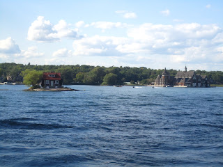
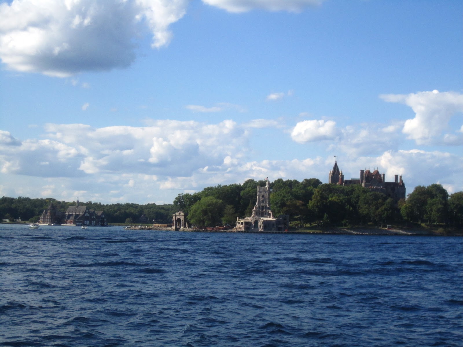
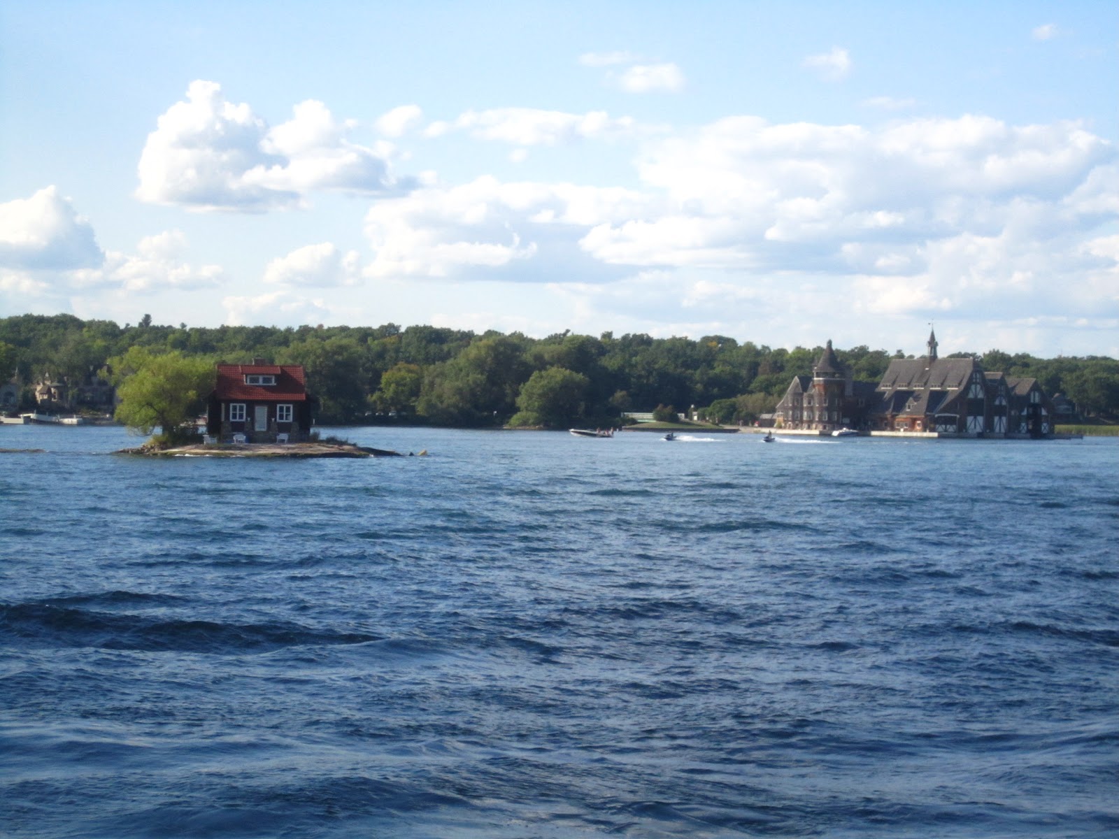
When we reached 1000 islands it was 4:00pm. We went by boat to look around the islands. There are small small islands which has house or trees in it. We saw one small international bridge between NY and Canada.
About 1000 islands
The 1000 Islands Region is an international tourism destination, encompassing communities on both sides of the US and Canada border along the St. Lawrence River and the eastern shores of Lake Ontario. The region takes its name from the more than 1000 islands that dot the lake and river along this international waterway. The region extends from Kingson to Cornwall on the Canadian side, and from Oswego to Massena on the US side, reaching inland to the foothills of the Adirondack mountains to embrace the communities that are west and north of the Adirondack Park, and the four NY Counties of Oswego, Jefferson, Lewis and St. Lawrence.
The 1,864 islands range in size from over 40 square miles to smaller islands occupied by a single residence, or uninhabited outcroppings of rocks that are only home to migratory waterfowl. To count as one of the Thousand Islands these minimum criteria had to be met: 1) Above water level year round; 2) Have an area greater than 1 square foot and 3) Support at least one living tree.

 We left 1000 islands and stayed in Holiday inn hotel. The next day our scheduled departure was at 7:00am. We couldn't found hotels for dinner, So we had parotas which we bought and slept nicely.
When we reached 1000 islands it was 4:00pm. We went by boat to look around the islands. There are small small islands which has house or trees in it. We saw one small international bridge between NY and Canada.
About 1000 islands
The 1000 Islands Region is an international tourism destination, encompassing communities on both sides of the US and Canada border along the St. Lawrence River and the eastern shores of Lake Ontario. The region takes its name from the more than 1000 islands that dot the lake and river along this international waterway. The region extends from Kingson to Cornwall on the Canadian side, and from Oswego to Massena on the US side, reaching inland to the foothills of the Adirondack mountains to embrace the communities that are west and north of the Adirondack Park, and the four NY Counties of Oswego, Jefferson, Lewis and St. Lawrence.
The 1,864 islands range in size from over 40 square miles to smaller islands occupied by a single residence, or uninhabited outcroppings of rocks that are only home to migratory waterfowl. To count as one of the Thousand Islands these minimum criteria had to be met: 1) Above water level year round; 2) Have an area greater than 1 square foot and 3) Support at least one living tree.
Sunday, July 8, 2012
Monsoon trip to Goa
We have decided to visit Goa in Monsoon. So Naveen booked the train ticket for us well in advance. While going we went by Airavata club class.We got the bus at 8:30pm from Majestic and reached Panaji at 9:30am. When we reached it was drizzling, we got one omni to drop to resort. The cab guys charging more there. We got it for 300Rs. We didn't bargain since it was very cloudy morning. We have booked the resort near to Condolim called Ruffels resort. Naveen had full plan about beaches so we hired three activa and started our ride. First we went to Chopara fort, I have mentioned the series of places we visited on first day.
Chopara fort: Before this present fort build by Portuguese, there was a one fort way long before, even before the arrival of Portuguese in Goa.
In 1683, In order to put the end on Portugal’s rule in Goa, Prince Akbar joined the forces of Marathas, who were bitter enemies of his Father Aurangzeb at that time, revolting against his Father; he sought refuge with them and made this place as their base camp. However Portugal had a scary experience with Marathas, after a horrific recovery from Marathas, Portuguese strengthen harder their Northern Defenses, learning from the experience of Maratha they were required to give the shelter for the people of region, this was not before 1717, that this present fort was built.
An awesome site with all sides having steep slopes. The fort stands above the whole upland area having irregular outer plan, outline of the higher slopes, uses the natural contours to add defensive height to the fullest advantage instead of dry ditches being dug.
At the top of the steep approach track on the main gate, which is small and unpretentious for so large fort, is deep and narrow. Depending on their position of the defense requirement, the bastions with their enormous embrasures for cannon are irregularly spaced, each having the cylindrical turret that gives a special character.
Vagator beach: Vagator beach is one of the most scenic beaches in Goa that is situated immediately north of the Anjuna beach overlooked by steep hills.
The crescent shaped beach has become a favorite spot among tourists for midnight parties. The beach is also well known as the 500 Old Portuguese fort of Chapora is situated nearby.
Actually there are two beaches in Vagator known as Big Vagator and Small Vagator. Big Vagator lined with dense palm plantations and white sand is the main beach that is undeniably beautiful.
Anjuna beach: Besides the calm waters of the Arabian Sea lapping softly on the Indian shore, Anjuna comes alive with its ever-famous full-moon parties and the Wednesday flea market to take one onto a trip.
Baga beach: Baga beach is an option for those who want to be away from the hustle and bustle found on the other beaches.
Baga Beach in Goa looks as if it has come straight out of a painting… Majestic white waves rushing to wipe out the feet imprints left by you on the white sand while the wind continues to flirt with the palm trees.
Goa's Baga beach is a small but perfect beach located between its two more famous cousins, Anjuna on one side and Calangute on the other. It is a good place to enjoy some quite moments and dwell in peaceful contemplation with oneself.
Calangute beach: Calangute beach in Goa is also known as the Queen of Beaches. The period from November to February is the most pleasant to visit here. It's 15km from the capital city Panjim. The beach itself isn't anything special, with steeply shelving sand, however it's capacity is large enough to accommodate the huge number of high-season visitors.
The Calangute beach is usually crowded and the small resorts thrive in business during the holiday season. It is one of the most popular beach in Goa with a host of facilities to cater to visitors, including Golden sand along the beach and water sports.
Candolim beach: Candolim beach in Goa is well known as one can find some of the best seafood in Goa. The beach has quite a number of shacks and beach restaurants that serve tasty dishes and drinks. The long and straight Candolim beach is dotted with dunes that offer little shelter. Also offering comfortable accommodation at the Candolim beach in Goa are the many hotels, guest houses and beach resorts.
So we had covered maximum places in one day. We had dinner in hotel called Eric's Karaoke where many were singing a song for Karaoke music. One foreigner was very enthu and he sung Papa kehte hai song with his accent which was very nice...
The next day we decided to visit St. xavier church which is in old Goa. So we started at 10.00 and reached by 11:00.
Basilica Of BomJesus, Old Goa
The Basilica of Bom Jesus is the most august and famous of all the churches in Old Goa. It contains the relics of St. Francis Xavier, Patron saint of Goa, Apostle of the Indies. He was known as Goencho Saib by most of the people of Goa. The construction of the church began on the 24th November 1594 AD from the funds bequeathed for this purpose by Dom Jeronimos Mascarenhas. It was blessed by the Archbishop Dom Fr Aleixo de Menezes on the15th May1605 AD. It became the first church in India to be elevated to the status of a minor basilica in 1946.
We saw the museum which is other side of the church, took some pics and headed towards Dona paula beach.
Dona Paula beach: Dona Paula beach is located just about 7-km from Panaji. This place is called the Lovers Paradise in Goa, named after Dona Paula de Menezes. A myth has been attached to this place and according one legend the Viceroy's daughter after facing objections from her family about her love affair with a poor fisherman jumped of the cliff.
The enticing story is about a girl named Dona Paula de Menzes, after whom the Goa beach has been named. She was the daughter of a viceroy in colonial India, who threw herself off the cliff, when refused permission to marry a local fisherman, Gaspar Dias.
The place where two of Goa's famous rivers meet the Arabian Sea is the bay of Dona Paula with a very good view of the Marmagao Harbour. 7-km from Panjim, situated on the south side of the, hammer-shaped headland that divides the Zuari and Mandovi, is a Fishing Village. This is a spot to sunbathe and relax.
Miramar beach: Miramar beach is situated 3 kms from Panaji in North Goa. A lovely Golden beach of soft sand girdled with palm trees facing the blue Arabian Sea, is the nearest to Panaji. Miramar is an urban beach where the Mandovi River meets the Arabian Sea. It is not a safe beach to swim as there is a strong undercurrent.
It was almost 3:00pm when we finished visiting above places and it was raining also. So we decided to have lunch. We went to Delhi darbar and had nice lunch. The food was really awesome. We came back to our place Candolim and from there went towards Auguda fort.
Auguda Fort: The Fort Aguada is one of the largest and impressive forts preserved as one of the best known landmarks in Goan history. Its prominence has grown from the fact that its headland on which it is built offers a wonderful site for military architects due to its shielding of the vital sea access from the heart of the Portuguese territory thereby making it an ideal site for seaward as well as landward defense.
The elimination of the Maratha threat and the acquisition of the New Conquest added more glory to its importance right upto the end of the 18th century when Goa's future borders were established. The most vital part of it was its impregnability to survive attacks by enemies through land or sea or simultaneously from both sides which often happened.
The largest of all springs, the Mother of Water or Mae de Agua is also found here. This part of the fort is closed for visitors as it is utilized as a prison. At the new gates to the prison area, there is a statue of a man and a woman, the man holding the body of a child in his arms while the woman has her arms raised to show the breaking of chain bondage in front of the national emblem of India, the Ashoka Pillar which has an inscription which is dedicated to the memory of people, dead and alive, known and unknown and who have laid down their life for the cause of freedom from foreign powers.
Sinquerim beach: The Sinquerim beach is a beautiful beach that has a spectacular stretch of sand. It is located at the south of the famous beaches like Baga, Calangute and Candolim. It is an ideal place for swimming and one should not miss visiting this beach when on their travel to Goa for beach holidays.
The beach at Sinquerim lies adjacent to the Aguada beach. Near the beach one can see the famous historical Fort Aguada that was built by the Portuguese to defend them from any attack from the sea route.
So we almost finished visiting north Goa. While coming back from the beach we went to the cafe called Charcoal and had beer and onion pakoda with finger chips.
Next day morning we left to Mudgaon and our train was at 3:30. We had lunch at hotel Raviraj. Our train was on time but it stopped in Launda station for more than 1:30hrs.
It was really a wonderful and memorable journey and I am not sure whether we can make the plan to Goa in monsoon again. Its totally different experience. One more thing is most of the restaurants and cafe are closed in monsoon season and we have to search for food.
Chopara fort: Before this present fort build by Portuguese, there was a one fort way long before, even before the arrival of Portuguese in Goa.
In 1683, In order to put the end on Portugal’s rule in Goa, Prince Akbar joined the forces of Marathas, who were bitter enemies of his Father Aurangzeb at that time, revolting against his Father; he sought refuge with them and made this place as their base camp. However Portugal had a scary experience with Marathas, after a horrific recovery from Marathas, Portuguese strengthen harder their Northern Defenses, learning from the experience of Maratha they were required to give the shelter for the people of region, this was not before 1717, that this present fort was built.
An awesome site with all sides having steep slopes. The fort stands above the whole upland area having irregular outer plan, outline of the higher slopes, uses the natural contours to add defensive height to the fullest advantage instead of dry ditches being dug.
At the top of the steep approach track on the main gate, which is small and unpretentious for so large fort, is deep and narrow. Depending on their position of the defense requirement, the bastions with their enormous embrasures for cannon are irregularly spaced, each having the cylindrical turret that gives a special character.
Vagator beach: Vagator beach is one of the most scenic beaches in Goa that is situated immediately north of the Anjuna beach overlooked by steep hills.
The crescent shaped beach has become a favorite spot among tourists for midnight parties. The beach is also well known as the 500 Old Portuguese fort of Chapora is situated nearby.
Actually there are two beaches in Vagator known as Big Vagator and Small Vagator. Big Vagator lined with dense palm plantations and white sand is the main beach that is undeniably beautiful.
Anjuna beach: Besides the calm waters of the Arabian Sea lapping softly on the Indian shore, Anjuna comes alive with its ever-famous full-moon parties and the Wednesday flea market to take one onto a trip.
Baga beach: Baga beach is an option for those who want to be away from the hustle and bustle found on the other beaches.
Baga Beach in Goa looks as if it has come straight out of a painting… Majestic white waves rushing to wipe out the feet imprints left by you on the white sand while the wind continues to flirt with the palm trees.
Goa's Baga beach is a small but perfect beach located between its two more famous cousins, Anjuna on one side and Calangute on the other. It is a good place to enjoy some quite moments and dwell in peaceful contemplation with oneself.
Calangute beach: Calangute beach in Goa is also known as the Queen of Beaches. The period from November to February is the most pleasant to visit here. It's 15km from the capital city Panjim. The beach itself isn't anything special, with steeply shelving sand, however it's capacity is large enough to accommodate the huge number of high-season visitors.
The Calangute beach is usually crowded and the small resorts thrive in business during the holiday season. It is one of the most popular beach in Goa with a host of facilities to cater to visitors, including Golden sand along the beach and water sports.
Candolim beach: Candolim beach in Goa is well known as one can find some of the best seafood in Goa. The beach has quite a number of shacks and beach restaurants that serve tasty dishes and drinks. The long and straight Candolim beach is dotted with dunes that offer little shelter. Also offering comfortable accommodation at the Candolim beach in Goa are the many hotels, guest houses and beach resorts.
So we had covered maximum places in one day. We had dinner in hotel called Eric's Karaoke where many were singing a song for Karaoke music. One foreigner was very enthu and he sung Papa kehte hai song with his accent which was very nice...
The next day we decided to visit St. xavier church which is in old Goa. So we started at 10.00 and reached by 11:00.
Basilica Of BomJesus, Old Goa
The Basilica of Bom Jesus is the most august and famous of all the churches in Old Goa. It contains the relics of St. Francis Xavier, Patron saint of Goa, Apostle of the Indies. He was known as Goencho Saib by most of the people of Goa. The construction of the church began on the 24th November 1594 AD from the funds bequeathed for this purpose by Dom Jeronimos Mascarenhas. It was blessed by the Archbishop Dom Fr Aleixo de Menezes on the15th May1605 AD. It became the first church in India to be elevated to the status of a minor basilica in 1946.
We saw the museum which is other side of the church, took some pics and headed towards Dona paula beach.
Dona Paula beach: Dona Paula beach is located just about 7-km from Panaji. This place is called the Lovers Paradise in Goa, named after Dona Paula de Menezes. A myth has been attached to this place and according one legend the Viceroy's daughter after facing objections from her family about her love affair with a poor fisherman jumped of the cliff.
The enticing story is about a girl named Dona Paula de Menzes, after whom the Goa beach has been named. She was the daughter of a viceroy in colonial India, who threw herself off the cliff, when refused permission to marry a local fisherman, Gaspar Dias.
The place where two of Goa's famous rivers meet the Arabian Sea is the bay of Dona Paula with a very good view of the Marmagao Harbour. 7-km from Panjim, situated on the south side of the, hammer-shaped headland that divides the Zuari and Mandovi, is a Fishing Village. This is a spot to sunbathe and relax.
Miramar beach: Miramar beach is situated 3 kms from Panaji in North Goa. A lovely Golden beach of soft sand girdled with palm trees facing the blue Arabian Sea, is the nearest to Panaji. Miramar is an urban beach where the Mandovi River meets the Arabian Sea. It is not a safe beach to swim as there is a strong undercurrent.
It was almost 3:00pm when we finished visiting above places and it was raining also. So we decided to have lunch. We went to Delhi darbar and had nice lunch. The food was really awesome. We came back to our place Candolim and from there went towards Auguda fort.
Auguda Fort: The Fort Aguada is one of the largest and impressive forts preserved as one of the best known landmarks in Goan history. Its prominence has grown from the fact that its headland on which it is built offers a wonderful site for military architects due to its shielding of the vital sea access from the heart of the Portuguese territory thereby making it an ideal site for seaward as well as landward defense.
The elimination of the Maratha threat and the acquisition of the New Conquest added more glory to its importance right upto the end of the 18th century when Goa's future borders were established. The most vital part of it was its impregnability to survive attacks by enemies through land or sea or simultaneously from both sides which often happened.
The largest of all springs, the Mother of Water or Mae de Agua is also found here. This part of the fort is closed for visitors as it is utilized as a prison. At the new gates to the prison area, there is a statue of a man and a woman, the man holding the body of a child in his arms while the woman has her arms raised to show the breaking of chain bondage in front of the national emblem of India, the Ashoka Pillar which has an inscription which is dedicated to the memory of people, dead and alive, known and unknown and who have laid down their life for the cause of freedom from foreign powers.
Sinquerim beach: The Sinquerim beach is a beautiful beach that has a spectacular stretch of sand. It is located at the south of the famous beaches like Baga, Calangute and Candolim. It is an ideal place for swimming and one should not miss visiting this beach when on their travel to Goa for beach holidays.
The beach at Sinquerim lies adjacent to the Aguada beach. Near the beach one can see the famous historical Fort Aguada that was built by the Portuguese to defend them from any attack from the sea route.
So we almost finished visiting north Goa. While coming back from the beach we went to the cafe called Charcoal and had beer and onion pakoda with finger chips.
Next day morning we left to Mudgaon and our train was at 3:30. We had lunch at hotel Raviraj. Our train was on time but it stopped in Launda station for more than 1:30hrs.
It was really a wonderful and memorable journey and I am not sure whether we can make the plan to Goa in monsoon again. Its totally different experience. One more thing is most of the restaurants and cafe are closed in monsoon season and we have to search for food.
Subscribe to:
Posts (Atom)